What if the difference between a high-yield subdivision and a stalled project isn’t the land itself, but the technical data you uncover before the first fence is moved? You likely understand that Queensland’s property market is currently experiencing the strongest price growth in the country, but you also know that the path to creating new titles is often blocked by complex council red tape and high-stakes regulatory hurdles. This guide provides a definitive roadmap on how to subdivide land in qld, ensuring you master the technical, legal, and strategic requirements of the Planning Act 2016 and the latest 2026 Brisbane City Council fee structures.
We’ll examine the critical integration of town planning and cadastral surveying, while addressing the hidden risks of underground utilities that often derail budgets. You’ll learn how to navigate the transition from initial feasibility to the final lodgement of survey plans with Titles Queensland, where new titles now cost A$90.65 per lodgement. By the end of this article, you’ll have the foresight to mitigate project risks and the strategic clarity needed to maximise your development’s ROI in a competitive market.
Key Takeaways
- Understand the legal framework of ‘Reconfiguring a Lot’ (RAL) under the Planning Act 2016 to align your project with current regulatory requirements.
- Discover the technical methodology of how to subdivide land in QLD by engaging a cadastral surveyor to establish the precise site data required for a successful application.
- Navigate the Development Application lifecycle with strategic town planning advice to manage assessable development hurdles and secure a favorable Decision Notice.
- Mitigate infrastructure risks during the operational works phase by integrating professional underground utility locating and CCTV pipe inspection into your site readiness plan.
- Streamline the final transition from physical works to new titles through meticulous plan sealing and compliance management to maximise your project’s ROI.
Table of Contents
- Understanding ‘Reconfiguring a Lot’ (RAL) under Queensland Planning Law
- The Foundation: Cadastral Surveying and Site Data Precision
- Navigating the Development Application (DA) and Planning Hurdles
- Site Readiness: Managing Utilities, Infrastructure, and Operational Works
- Executing Your Vision: Plan Sealing, Titles, and Strategic Partnerships
Understanding ‘Reconfiguring a Lot’ (RAL) under Queensland Planning Law
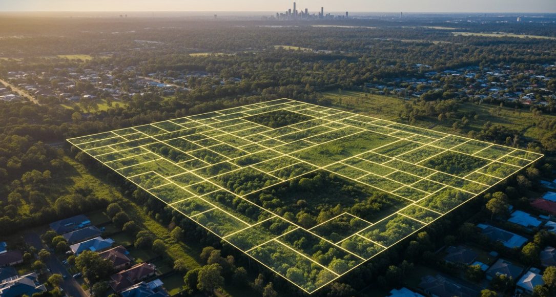
In the Queensland regulatory environment, the term ‘subdivision’ is a subset of a broader legal classification known as Reconfiguring a Lot (RAL). This classification, established under the Planning Act 2016, encompasses the creation of new titles, the rearrangement of existing boundaries, and the merging of multiple parcels into a single entity. Understanding these nuances is essential when determining how to subdivide land in qld, as the specific category of your RAL will dictate the complexity of your Development Application (DA) and the subsequent professional services required. The historical context of these boundaries often traces back to Queensland’s administrative land divisions, which provide the foundational framework for modern cadastral records and the registration of new interests in land.
Precision in terminology isn’t just a matter of semantics; it’s a strategic necessity. When you submit a DA, the council evaluates the proposal against specific codes that vary based on whether the reconfiguration involves a simple boundary realignment or the creation of dozens of new residential allotments. Misclassifying your project at the outset can lead to costly delays or the imposition of inappropriate conditions that erode your project’s feasibility. By aligning your strategy with the formal definitions used by local authorities, you ensure a smoother transition through the assessment process.
The Legal Framework: Planning Act 2016 and Beyond
The Planning Act 2016, with the latest reprint effective from 27 May 2026, serves as the primary legislative pillar for all land-use decisions across the state. While this act sets the baseline, local planning schemes like the Brisbane City Plan 2014 provide the granular detail that governs specific precincts. For example, Brisbane City Council utilizes a point-based system for fee calculation, with the dollar value of a point for the 2025-26 financial year set at A$143.00. This means a standard reconfiguration application for up to two lots carries a base fee of A$4,290.00.
Developments are typically categorized as either ‘Accepted’ or ‘Assessable’. Accepted development doesn’t require a full DA if it complies entirely with the relevant benchmarks. However, most subdivisions are ‘Assessable’, meaning they require a formal assessment against the planning scheme’s performance outcomes. This is where strategic town planning becomes vital, as it allows developers to navigate the complexities of State Planning Policies that might override local rules in regional growth corridors.
Common Types of Subdivision in Queensland
Successful developers must identify the most strategic subdivision model for their site’s unique characteristics. The choice of model impacts everything from infrastructure requirements to the final marketability of the new lots. Common structures include:
- Traditional Residential Splits: Often referred to as “one-into-two” developments, these are the backbone of urban infill projects.
- Community Title Schemes (CTS): Essential for townhouses and units, these schemes involve shared common property and are governed by a body corporate.
- Volumetric Subdivisions: These define three-dimensional space above or below the ground, frequently used in complex mixed-use developments where commercial and residential interests overlap.
Identifying the right path early is the most effective way to manage how to subdivide land in qld while maintaining control over your timeline and budget. With lot registrations in areas like Moreton Bay reaching 1,235 in the March 2026 quarter, the demand for precise, legally compliant subdivision is higher than ever.
The Foundation: Cadastral Surveying and Site Data Precision
The success of a subdivision project rests entirely on the precision of its initial data. While many developers view surveying as a final administrative step, a registered cadastral surveyor should be the first professional engaged. In Queensland, only those registered with the Surveyors Board of Queensland have the legal authority to define land boundaries and prepare the plans required for title registration. This professional oversight ensures project integrity from the outset. Engaging a team that specializes in cadastral surveying ensures that your project is built on a foundation of accuracy rather than assumptions.
Moving beyond simple boundary identification, a strategic approach involves comprehensive site mapping that informs every subsequent decision. Precision data acts as the antidote to the uncertainty that often plagues large-scale developments. By establishing exact boundary locations early, you prevent the costly boundary disputes and encroachment issues that can stall a project during the construction phase. This intellectual preparation allows you to navigate the physical and regulatory landscape with the quiet authority of an expert who understands exactly where the project sits in relation to its neighbors.
The Disclosure Statement and Disclosure Plan
Queensland legislation mandates that developers provide buyers with a clear representation of what they are purchasing before a contract is signed. This requirement centers on the Disclosure Plan, which must detail the proposed lot’s dimensions, orientation, and any significant easements. The disclosure plan serves as the primary legal link between survey data and the sales contract. Without this document, which must be prepared by a cadastral surveyor, a developer risks contract terminations or legal challenges. It acts as a legal safeguard, ensuring that the final registered title matches the promises made during the off-the-plan sales phase.
Topographical Mapping and Site Constraints
Understanding how to subdivide land in qld requires more than just knowing where the fences sit. Topographical surveys provide a three-dimensional view of the terrain, which is vital for managing drainage, slope stability, and infrastructure placement. In the 2026 development environment, where environmental regulations are increasingly stringent, identifying unbuildable areas early is critical to maximizing lot yield. By integrating cadastral data with high-precision topographical mapping, you can align your engineering requirements with the natural contours of the land. This foresight prevents the costly redesigns that occur when paper approvals meet the reality of a site’s physical constraints.
Navigating the Development Application (DA) and Planning Hurdles
Securing a Decision Notice represents the most significant milestone in the administrative phase of your project. The lifecycle of a Development Application (DA) begins with formal lodgement, moves through a rigorous assessment period, and ideally concludes with a negotiated approval. For developers exploring how to subdivide land in qld, the ‘Assessable’ development pathway is the standard route. This process requires sophisticated town planning advice to ensure the proposal aligns with the Planning Act 2016 and specific local overlays. A well-prepared application doesn’t just ask for permission; it builds a logical case for the project’s compliance and long-term viability.
The assessment period often involves an Information Request phase. This is a critical window where council planners seek clarification on technical details such as traffic impact, environmental management, or infrastructure capacity. Handling these requests with precision is vital. It’s the primary opportunity to negotiate the “Conditions of Approval” before they are set in stone. If these conditions are too onerous, they can become roadblocks that threaten the project’s financial feasibility. Proactive management during this stage ensures that the final Decision Notice is both achievable and profitable.
Pre-Lodgement Strategy: The Proactive Developer Approach
Strategic developers rarely lodge a DA without prior consultation. Pre-lodgement meetings with councils like Brisbane or the Gold Coast allow you to present your vision and identify “fatal flaws” before committing to full application fees. In Brisbane, where a base fee for a two-lot reconfiguration is A$4,290.00, avoiding a refusal is a matter of fiscal responsibility. We use precise site data to support planning arguments, demonstrating that the proposed subdivision respects the local character while meeting modern density requirements. This intellectual preparation reduces friction and accelerates the approval timeline.
Meeting Council Infrastructure Requirements
Approval is often contingent on meeting strict infrastructure requirements. These “hidden” costs of subdivision include infrastructure charges, which contribute to the broader network of parks, transport, and sewerage. Beyond these fees, you must plan for physical connections to water and wastewater networks. Once the DA is approved, the project typically moves into the Operational Works (OPW) phase. This requires separate permits for the actual civil construction. For 2025-26, Brisbane City Council’s OPW application fees start at A$2,145.00 for up to five allotments, emphasizing the need for meticulous budget forecasting during the planning phase.
Site Readiness: Managing Utilities, Infrastructure, and Operational Works
Moving from the administrative success of a Decision Notice to the physical reality of the site requires a shift in focus toward rigorous risk mitigation. While the theoretical phase of how to subdivide land in qld is complete, the execution of on-ground works introduces significant physical variables that demand technical precision. Relying solely on “Dial Before You Dig” (DBYD) plans is a common but dangerous oversight for professional developers. These plans provide a general indication of asset locations but lack the precision required for heavy excavation, often failing to account for abandoned lines or undocumented service upgrades.
Strategic site readiness involves the integration of underground utility locating to establish a definitive map of the subsurface environment. This process identifies the exact depth and alignment of telecommunications, gas, and electrical lines that standard records often miss. Beyond locating, you must also verify the structural integrity of existing assets. CCTV pipe inspection allows you to confirm that stormwater and sewerage infrastructure is fit for the increased hydraulic load of new allotments, preventing the costly failure of council-vested assets after the project is finalised.
Subsurface Utility Engineering (SUE) in Subdivision
Subsurface Utility Engineering (SUE) utilizes non-invasive technologies like Ground Penetrating Radar (GPR) to detect metallic and non-metallic assets without disturbing the soil. When high-risk assets are identified, vacuum excavation provides a non-destructive digging method to physically verify the exact location and condition of the utility. This intellectual preparation ensures that design plans are based on reality rather than outdated schematics. Systematic subsurface utility engineering reduces the frequency of utility strikes, which can decrease insurance premiums and project delays by up to 25% for complex urban developments.
Managing Operational Works (OPW)
Operational Works (OPW) encompass the civil construction components of the project, including roadworks, drainage systems, and bulk earthworks. These works must be executed in strict accordance with the standards set by local authorities like Brisbane City Council or Unitywater. Effective management during this phase involves meticulous supervision of contractors to ensure compliance with the original engineering specifications. This level of oversight is essential because any deviation can result in the council refusing to accept the infrastructure during the final handover.
At the conclusion of construction, “As-Constructed” surveys are mandatory to document the final position of all new assets. These surveys provide the verified data that proves the physical infrastructure matches the approved engineering plans. This data is the primary evidence required for the plan sealing phase, which we’ll examine in the final section. Without accurate as-constructed data, the transition from physical works to the registration of new titles can be indefinitely delayed.
Executing Your Vision: Plan Sealing, Titles, and Strategic Partnerships
The final phase of a subdivision project is where technical execution meets legal finality. Once the physical works are complete, you must demonstrate absolute compliance with every condition listed in your Development Application (DA) Decision Notice. This is a meticulous audit process where the council verifies that all infrastructure, from drainage to road widening, meets their specific standards. Understanding the administrative intricacies of how to subdivide land in qld at this stage is vital, as any overlooked condition can halt the transition from a construction site to a marketable asset.
The plan sealing process serves as the council’s official “seal of approval” on your survey plan. In Brisbane, for the 2025-26 financial year, this involves a base charge of A$572.00, plus an additional A$429.00 for every lot on the survey plan. Beyond council approval, you must manage legal encumbrances, including obtaining Mortgagee Consent if the property is under finance. Your bank must formally agree to the new lot boundaries before the survey plan can be lodged with Titles Queensland. Final lodgement fees currently stand at A$476.31 for the plan itself, with an additional A$35.04 per lot, followed by A$90.65 for the issuance of each new indefeasible title.
The Plan Sealing Bottleneck: How to Clear It
Delays in plan sealing often stem from unpaid infrastructure contributions or outstanding bonds. Councils won’t release the sealed plan until every financial obligation is settled and all “as-constructed” data is verified. To avoid these bottlenecks, ensure your cadastral surveyor has certified the final plan against the physical markers on-site well in advance. Meticulous documentation of all site works, including the utility clearances established in earlier phases, provides the evidence council officers need to fast-track their final review. It’s about proving that the reality on the ground matches the vision approved on paper.
Why a Unified Approach Wins in the 2026 Market
The 2026 Queensland property market rewards developers who prioritize data integrity and professional alignment. Navigating the lifecycle of a subdivision requires more than just sequential steps; it demands the integration of town planning, high-precision surveying, and advanced utility locating into a single, cohesive strategy. This multidisciplinary approach eliminates the communication gaps that lead to costly redesigns and regulatory friction. By centralizing these technical disciplines, you ensure that every decision, from the initial boundary identification to the final title lodgement, is backed by expert foresight.
Zenith Developers provides the steady hand and industry expertise required to transform complex land parcels into high-yield developments. Our team manages the technical and regulatory complexities so you can focus on maximizing your ROI. Partner with Zenith Developers for Your Next QLD Subdivision to ensure your project is built on a foundation of precision and professional excellence.
Securing Your Stake in Queensland’s Future
Successful subdivision in 2026 demands a transition from reactive problem-solving to a proactive, data-driven strategy. By integrating precise cadastral surveying with sophisticated town planning, you navigate the complexities of the Planning Act 2016 while mitigating the physical risks of underground infrastructure strikes. This methodical approach ensures that your project moves seamlessly from an initial site assessment to the issuance of new titles without the friction of unexpected regulatory or technical hurdles. Mastering how to subdivide land in qld requires a partner who understands that intellectual preparation is the most effective way to protect your ROI.
Zenith Developers provides the steady hand and technical foresight required to manage every phase of your project lifecycle. Our team combines the technical rigor of expert cadastral surveyors and advanced underground utility locating with strategic town planning services to deliver a single, cohesive development objective. We prioritize quality and responsible growth, ensuring your vision is realized with meticulous accuracy and professional integrity.
Secure Your Development Success with Zenith Developers and position your next project for long-term excellence in a competitive market. The opportunity within the Queensland landscape is significant; let’s ensure your project is built on a foundation of precision.
Frequently Asked Questions
What is the minimum lot size for subdivision in Brisbane?
Minimum lot sizes in Brisbane are governed by the Brisbane City Plan 2014 and vary significantly by zoning. For example, Low Density Residential zones typically require a minimum of 400sqm, while Character Residential or Low-Medium Density zones may allow lots as small as 300sqm. You should always verify the specific precinct overlays and neighbourhood plans, as these local instruments often override general zoning rules to preserve local character or manage infrastructure capacity.
How much does it cost to subdivide land in QLD in 2026?
Total costs vary based on project scale, but mandatory government fees provide a baseline for your budget. For the 2025-26 financial year, Brisbane City Council charges a base fee of A$4,290.00 for a two-lot reconfiguration, while Titles Queensland requires A$90.65 per new title issued. You must also account for professional consultancy fees and infrastructure charges, which contribute to the network of local parks and transport services.
How long does the land subdivision process take in Queensland?
A standard subdivision typically requires six to twelve months to move from initial survey to the issuance of new titles. This timeline includes the development application assessment, civil construction under an operational works permit, and the final plan sealing phase. Strategic preparation, such as conducting pre-lodgement meetings, can help streamline the process and prevent the information requests that often cause administrative delays during the council review period.
Do I need a lawyer or a town planner to subdivide my land?
You’ll require a town planner to navigate the development application process and a lawyer to manage the legal transfer of titles. While a town planner ensures your proposal meets the performance outcomes of the local planning scheme, a solicitor handles the contractual obligations and mortgagee consents. Engaging these professionals early allows you to address the technical requirements of how to subdivide land in qld with expert precision.
Can I subdivide my land if I have a mortgage?
You can subdivide mortgaged land provided you obtain formal Mortgagee Consent from your lending institution. The bank must review and sign the final survey plan before it’s lodged with Titles Queensland for the registration of new interests. This step ensures the lender’s security is correctly allocated across the newly created lots, so it’s vital to involve your financial institution early in the plan sealing phase to avoid settlement delays.
What is a “sunset clause” in an off-the-plan subdivision contract?
A sunset clause is a contractual provision that establishes a definitive deadline for the registration of the new survey plan. If the developer fails to create the new titles by this date, either party may have the right to terminate the contract. This clause provides a safety net for buyers in off-the-plan sales, but developers must manage their construction and plan sealing timelines meticulously to ensure they meet these critical legal milestones.
What happens if there are underground pipes where I want to build?
If underground assets are present, you must identify their exact alignment and depth using professional underground utility locating and CCTV pipe inspection. Discovering a main sewer or stormwater pipe late in the process can force a complete redesign of your building envelopes. Once located, you may need to apply for a permit to build near the asset or adjust your infrastructure plans to ensure the long-term protection of the utility network.
Do I need council approval for a simple boundary realignment?
Council approval is mandatory for boundary realignments because they fall under the legal definition of Reconfiguring a Lot (RAL). Even if you aren’t creating additional allotments, changing the position of a boundary line requires a development application to ensure the resulting parcels remain compliant with minimum size and frontage standards. This process concludes with a new survey plan being lodged to update the official land registry records.